Understanding What Geologists Look For
The successful search for gold starts way before a drilling machine is stationed at the location. Geologists are required to first come up with the very detailed geological model of the area being investigated. This step demands finding out the rocks that are likely to contain gold, knowing the tectonic history of the region, and checking for surface indications that might point to the existence of mineral deposits at deeper levels.
Gold ores are created in certain geological settings. A large part of the world’s most important sources of gold is classified according to these deposit types like orogenic gold systems, epithermal systems or intrusive related systems. Each type has different attributes and the skilled geologists are able to tell them apart by careful work in mapping, sampling, and observation.
Rock Types and Structures
Not all rocks can host gold. Geologists pay close attention to rock composition and structural features because these often control how gold bearing fluids moved through the crust. Faults, fractures, shear zones and folds act as pathways that bring mineral rich fluids to the surface and concentrate them in favourable locations.
In places like the Yukon, Alaska or northern Ontario, long geological histories have created complex structural networks. These features become the backbone of exploration theories. When geologists map these structures on the ground, they are essentially reading the landscape for clues about how gold could have been transported and trapped.
Alteration and Surface Signatures
Gold deposits are often associated with alteration minerals such as quartz, carbonate, sericite or sulphides. These minerals form when hot fluids interact with surrounding rocks. Even when gold itself is not visible, alteration minerals are key indicators that mineralized systems may be nearby.
Surface sampling helps confirm these suspicions. Geologists collect soil, rocks and sediments to look for geochemical anomalies. Soil that contains elevated gold or associated elements such as arsenic, antimony or silver can highlight trends that align with underground structures. These anomalies guide further investigation and help define priority targets.
The Importance of Grade
One of the most misunderstood concepts in gold exploration is grade. Grade refers to the concentration of gold found in a rock sample and is usually measured in grams per tonne. A higher grade means more gold is present, but grade cannot be evaluated in isolation. The economic value of a deposit depends on grade, tonnage, mining method, metallurgy and access to infrastructure.
High Grade vs Low Grade
The high-grade deposits are those that contain very high concentrations of gold. If these deposits are continuous and accessible, they can yield a huge profit. Poor-quality deposits can still be a source of profit if they are of large volumes. The majority of open-pit mines work at low grades, however, they are able to process high tonnage effectively thus being able to cover all their costs and more.
One has to acquire the knowledge of the occurrence of gold in the rock in order to fully comprehend the grade. Gold may be covered in sulphide minerals, reside in quartz veins, or be distributed in small amounts throughout the altered zones. Laboratory testing provides information about the gold's recoverability which is one of the main economic potential evaluation aspects.
The Role of Drilling
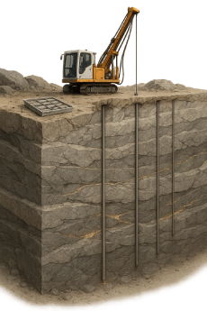
Drilling is the turning point in exploration. All earlier steps provide hints and models, but drilling provides physical evidence. Drill holes reveal the composition of rocks below the surface and confirm whether gold is present at depth. Without drilling, exploration cannot move forward.
Diamond Drilling
Diamond drilling is the preferred method for exploring hard rock environments. It produces a continuous core that geologists examine carefully. Every section of core is logged, sampled and analyzed. The core offers insight into rock types, structural orientations, alteration patterns and the presence of gold and minerals.
Drilling patterns evolve over time. Early programs use widely spaced holes to understand the deposit’s general dimensions. If results are encouraging, drilling becomes more detailed to define grade and continuity. This gradual progression helps reduce risk and ensures that resources are allocated responsibly.
How Geologists Identify Prospective Zones
Finding a gold deposit begins with understanding the geological story of a region. Gold is not distributed randomly across the earth. It forms in areas that experienced specific geological processes such as volcanic activity, mountain building, fluid circulation or deep crustal movement. Because of this, certain regions naturally become prime exploration zones.
Geologists study the big picture first. They look at regional tectonics, the age of the rocks and the history of deformation. These large scale patterns help determine whether the conditions for gold formation ever existed. Once they identify the right environment, they zoom in to examine smaller scale structures and local anomalies.
The Role of Geological Mapping
Geological mapping is one of the oldest and most reliable exploration tools. It involves observing rock outcrops, mineral veins, fault lines and alteration zones directly on the ground. Mapping provides essential context because it helps geologists understand how different rock units interact.
Every detail matters. The color of a rock, the thickness of a mineralized vein or the angle of a fracture can provide evidence of how mineral bearing fluids moved. Mapping also identifies regions where erosion has exposed deeper structures that could point toward gold bearing systems.
In remote regions such as the Yukon, mapping must often be supported by helicopter access and long traverses on foot. The landscape can be rugged, but this isolation is part of what preserves mineral belts for exploration.
Geochemical Surveys
Geochemical surveys analyze the chemical composition of soils, rocks, sediments or even vegetation. They reveal subtle traces of gold and its associated pathfinder elements. Pathfinder elements such as arsenic, antimony, bismuth or tungsten often accompany gold mineralization because they are carried by the same fluids.
Soil sampling is especially valuable in areas with little bedrock exposure. In glaciated regions, including much of northern Canada, till sampling is a powerful method because glaciers can carry small fragments of gold rich rocks over long distances. By analyzing these fragments, geologists can trace them back to their source.
Geochemical surveys help transform broad search areas into clearly defined targets, making exploration more efficient and cost effective.
Geophysical Techniques
Geophysical surveys disclosing the subterranean's physical characteristics. There are various geophysical techniques including magnetic surveys, resistivity surveys, gravity measurements and induced polarization which benefit from the individual characteristics of different geological formations.
The magnetic surveys detect areas of differing magnetic properties between rocks and very often cause the eruption of anomalies due to the presence of faults, intrusions, or iron-rich formations. It is also the case that the detection of sulphide-rich zones by induced polarization methods is very much possible, and these zones could be the ones containing gold as well.
Surveying with airborne geophysics gives the opportunity to rapidly explore large areas for the resource. This plus point is extremely important in the case of the Yukon or Nunavut where the terrain is mostly unavoidable. Hence, geophysics facilitation does not replace drilling but assists with drill targeting remarkably more precise.
Why Certain Regions Become Gold Belts
Some regions of the world are famous for hosting multiple gold deposits. These areas are known as mineral belts. They exist because specific geological processes occurred repeatedly over millions of years, creating favorable conditions for gold to form again and again.
Canada has several well known mineral belts including the Abitibi Greenstone Belt in Ontario and Quebec, the Golden Triangle in British Columbia and the White Gold District in the Yukon. These belts attract explorers because they offer proven geological potential.
The Influence of Geological History
A gold belt forms when multiple events align. First, the region must contain rocks capable of hosting mineralization. Second, it must experience tectonic or volcanic activity that generates mineralizing fluids. Third, structural deformation such as folding or faulting must create openings for the fluids to flow.
These processes often occur during mountain building events known as orogenies. The Yukon, for example, has a long history of tectonic collisions, volcanic activity and crustal uplift. This history created deep seated structures that act as channels for gold bearing fluids.
Geologists study the history of these belts because understanding past tectonic events helps predict where new deposits may exist.
Prospectivity and Exploration Success
Mineral belts are attractive because they reduce geological risk. If a region has produced gold before, the likelihood of finding additional deposits increases. However, even in well known belts, discoveries require meticulous work and careful interpretation.
Explorers examine why certain deposits formed where they did. They look at patterns in rock types, structural trends and geochemical signatures. These patterns can often be extrapolated into unexplored territory, guiding new drilling programs.
The history of exploration shows that new discoveries frequently occur near existing deposits, but they also happen in frontier areas where technology reveals hidden potential.
The Path from Discovery to Definition
Once explorers find evidence of gold, the project enters a new stage focused on verifying, measuring and understanding the deposit. This is where drilling becomes essential.
What Drilling Reveals
Drilling confirms whether gold exists at depth. It provides rock samples that offer direct insight into grade, mineralization style and geological structure. A single drill hole can transform a theoretical target into a genuine discovery.
Core samples show how gold is distributed: whether in narrow veins, broad alteration zones or sulphide rich intervals. This information helps geologists understand the geometry of the deposit and how it might continue underground.
Defining the Deposit
After a discovery is confirmed through initial drilling, the next step is definition drilling. This phase focuses on understanding the size, shape and grade distribution of the deposit. Drill holes are placed in a systematic pattern to create a three dimensional picture of the mineralized body.
Geologists use this data to build geological models that show how the deposit extends underground. These models help determine whether the deposit has continuity, which is essential for future economic studies. A deposit must be consistent and predictable to support long term development.
Quick Links
🇨🇦 Newfoundland and Labrador just became one of the hottest mining jurisdictions in Canada.
— Juniorstocks.com (@Junior_Stocks) November 24, 2025
Record exploration. High-grade discoveries. Valentine Lake’s first pour.
New Found Gold ignited the spark and now the whole province is booming.
The Rock is officially gold country… pic.twitter.com/beJkB2ZNw0
With the kind help from
